Photoblog: Chelvara Falls, Kabbe Hillu & Tadiandamol Trek
Trekking & Hiking in Coorg - Tadiandamol, Kabbe Hills and Chelvara Falls
First time we did this trek around Sept'16. We were truly mesmerised by the beauty of this trek and the surrounding areas. We again did a monsoon trek in July 2017. One can do a winter trek here as well from Oct to Feb. Throughout the year this place has something new to offer in terms of thrill, adventure and beauty.
Tadiandamol loosely means Broad Mountain or Large Mountain in Local Kodava Language. It is 4th highest peak (1,748 Meters) in Karnataka after Mulayyanagiri (1,925 Meters), Baba Budangiri (1,895 Meters) and Kudremukh (1,894 Meters). It is around 285 Kms away from Bangalore and around 30 kms from Virajpet.
 |
| We started the trek on Saturday morning and returned by Sunday night. In these 2 days, we visited Chelvara Falls, trekked to Tadiandamol peak and visited Nalaknad Palace. |
 |
| Restaurants and eating joints between Bangalore and Mysore offers authentic Karnataka breakfast. This visit in itself is an attraction which I look forward to when I am out on one of these trips. One of my favourite is Shivalli MTR Restaurant, Kamat, Thhatte Idly near Bidadi to name a few. |
 |
| Monsoon is one of the best time to visit Coorg from greenery point of view. Rain may however spoil and make trekking, travelling difficult. We went at a time when monsoon season was on retreat. The place we stayed was at one of the most spectacular location - surround by hills and with a private stream of their own! Good food, Friendly staff and prompt service. We left Bangalore around 5 am and reached the resort (which is around 30 kms from Virajpet) around 2pm. |
 |
| A small natural Stream inside the homestay creates a small, beautiful pond of clear water. The resort has facilities for few water activities like kayaking, swimming etc. Its a good place to relax a day before trek. |
 |
| After relaxing for 1 hour and settling down in the resort, we moved to Chelavara falls. After around 10 kms drive from the main road, we reached the entrance of the falls. From the entrance, there is around 10-15 mins descent to the falls. The path can be riddled with leeches in monsoon. |
 |
| We went to the base of the falls. The view is stunning and waterfall sound deafening (yet soothing). Warning: Do not enter the water as the pool at the base is deceptively deep and filled with large rocks. It is said that there are around 20 deaths around these falls. |
 |
| On our way to Kabbe Hills. Kabbe hills are beautiful meadows around 10 kms away from Chelavara falls. After spending 1 hours at Chelvara falls, we moved to Kabbe Hills. Its on the same road and Jeep, Car can go till the base of the hill. There is a small car parking and few houses. After walking around 1 km, we reached a small pond (which is almost dry now). |
 |
| Kabbe Hills.Who needs Ireland, when we have our own beautiful meadows just 300 kms away. A photograph cannot do justice to the beauty of this place. It is spectacularly beautiful and green all around. There are around 2 other small peaks nearby which one can explore. Since we were getting late, we moved out around 5:30pm. It may get dark and foggy suddenly during monsoon season. A must visit place. |
 |
| The beautiful Kabbe Hill. |
 |
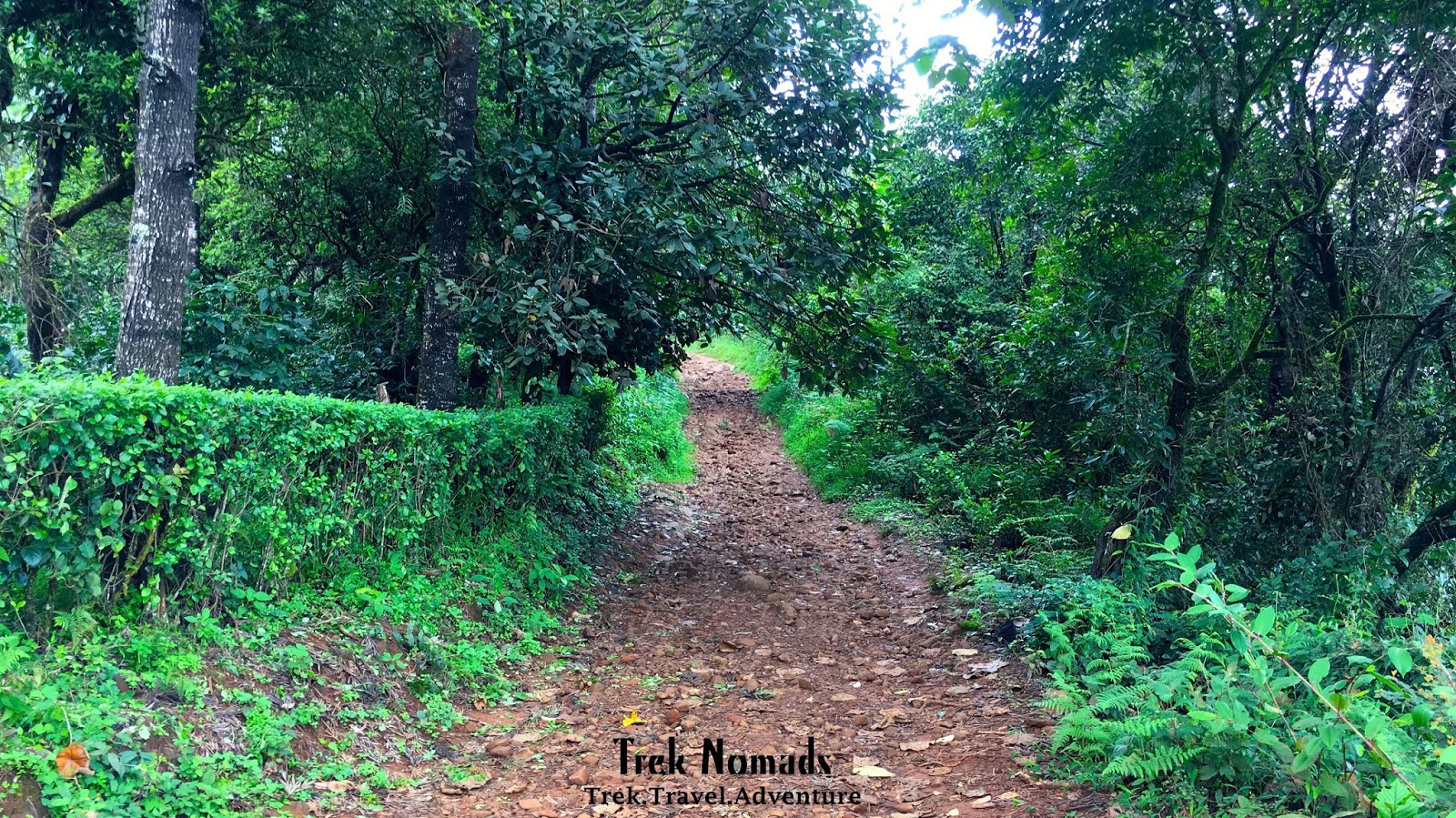
| Next Day, early morning around 7:30am, we started our trek to Tadiyanadamol. From main road there is a road which goes towards Tadiayandmol parking. it is around 10 kms from the main road. The road is steep and only a powerful (or 4X4) car can go up the road. Our i10 Sports could not climb and we had to part near the Nalknad Palace. Many other smaller cars had the same fate, but unlike us it was difficult for them to turn around and come back to safer place for parking. From Palace, we hiked around 4 kms to reach the base camp or car parking. It is around 4 kms from this point to the peak. |
 |
| The road from Nalknad Palace to Tadiyanadmol Parking spot. It is difficult for less powerful cars to climb this 4 kms road. It is advisable to hike from the palace as this route is also beautiful. |
 |
| This is where the hike to Tadiandamol Starts. The trail around 4 kms. There are around 2 streams on the way which can be a water refuelling station. The ascent is moderate till halfway, where you will reach Elephant Rock. |
 |
| Stream of clear and sweet water. |
 |
| The Trail. We saw elephant dung on our way to the top. This place is frequented by elephants especially at night as per locals. |
 |
| Flowers on the way. |
 |
| Flowers on the way. |
 |
| This is half way point in the trek. The trail becomes rocky and steep after this point. It is advisable to keep a walking stick with you for support. This will be helpful specially when you are coming down. |
 |
| The trail after Elephant walk. It was slippery due to recent rains. It is also infested with Leeches. So if something tickles you in your legs, while you are trekking, you know who it is! |
 |
Karnataka's own small Valley of Flowers. Surprisingly the hills near the peak were filled with lots of flowers. We photographed around 10 varieties of flowers. Some flowers were similar to Himalayan flowers. (Distant cousins  ) ) |
 |
| The trail through forest..around 700 meters. After around 1 km from the Elephant rock, there is a Lord of the Rings kind of forest. The visibility drops to not more than 2-3 meters. We were climbing on roots of large trees. There is all kind of insect noises and little light. It was scary but fun. We were really happy to come out of the forest after around 20-30 mins of treacherous climb. |
 |
| Leech... They are not dangerous but they suck your blood. Once they are full, they drop off. Still no one likes an insect sucking blood. Few tips so that these harmless, bloodsucking monsters stay away from you: Wear Leech Protector, Lime Stone, Tobacco etc. I used none of these and was bitten by one tiny leech. I didn't know about the bite till I came back home! Next time will try one of the tips. |
 |
| Ahaetulla nasuta - The green vine snake. We encountered this snake while coming down from the peak. It was right on our path and barely visible due to its sleek body and greenish surrounding. Fortunately I did not step on it. This snake can be mildly poisonous. (as long as its like drinking 1 strong beer its fine ). But its better not to take chances with wild animals and insects. This area is also infested with snakes like cobras, vipers and King Cobras. It is always better to keep your eye on where your feet are going. |
 |
| The summit...final climb. The final climb is around 1 kms and steeper than other points in the trek. It was also slippery due to rains. Due to fog, it was difficult to see how far it is. That added to the excitement! |
 |
| Another Snake... This was a tiny, few inches long, non poisonous snake. It was trying to eat an earthworm. We felt like National Geographic photographers. But since the process of hunting and eating was slow (the worm had given up already!), we got bored and left. |
 |
| Nalknad Palace It loosely means surrounded by 4 villages. It is located near a village named Yavakapadi and was built between the years 1792 and 1794 AD. This palace was the last refuge of the last of the Haleri kings of Kodagu, Chikka Veerarajendra before he was deposed by the British. (wiki). Photography inside the palace is not allowed. I have no idea why! However the palace gives you glimpse of how kings used to live couple of hundred years earlier. |
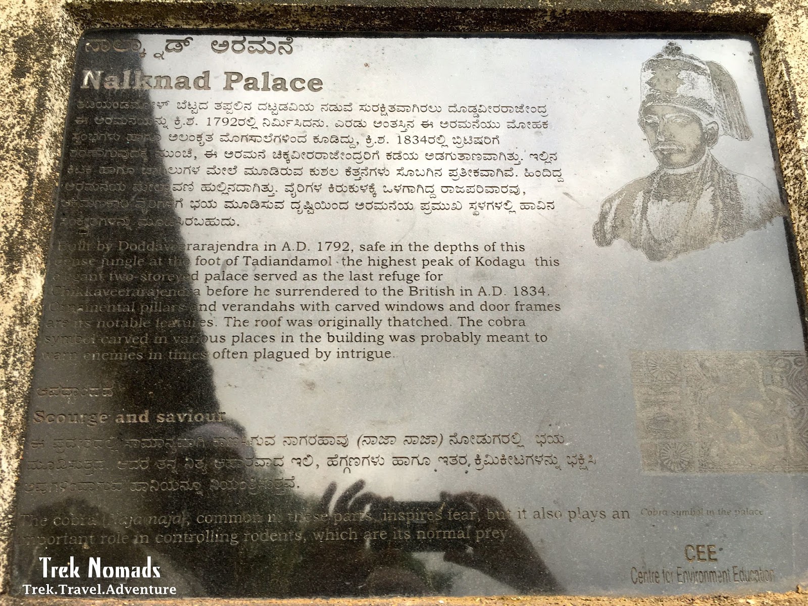 |
| Details about Nalknad Palace. |
 |
| Wild Elephants on our way back from the trek. End of one of the most beautiful and eventful trek. |
Please follow our Facebook page, for details itineraries for similar treks in Western Ghats and Himalayas.


ReplyDeleteSuch a nice information given in this blog...If you are planning for your holiday tours packages,
char dham tours packages, Car Rental etc. We are Char Dham Tour Operators in Haridwar Leading Travels Company in Haridwar Uttarakhand.
Hello sir ,
ReplyDeleteI am a student from punjab and I make blogs regarding travelling . Sir can you please guide me about blogging on blogger . I will be very thankful to you .
Mail : krishkagra02@gmail.com